As the only location in Maryland where Carroll, Frederick, Howard, and Montgomery counties come together, Parr’s Spring occupies a special place in the state’s geography and history.
Beyond its use as a boundary marker, this historically noteworthy site also serves as the headwaters of the Patapsco River’s South Branch, which eventually empties into Baltimore Harbor. Despite changes in county lines throughout the ages, the spring—named after 18th-century landowner John Parr—has been identified on maps and in land records from at least 1726 and has continuously been a key landmark for county delineations.
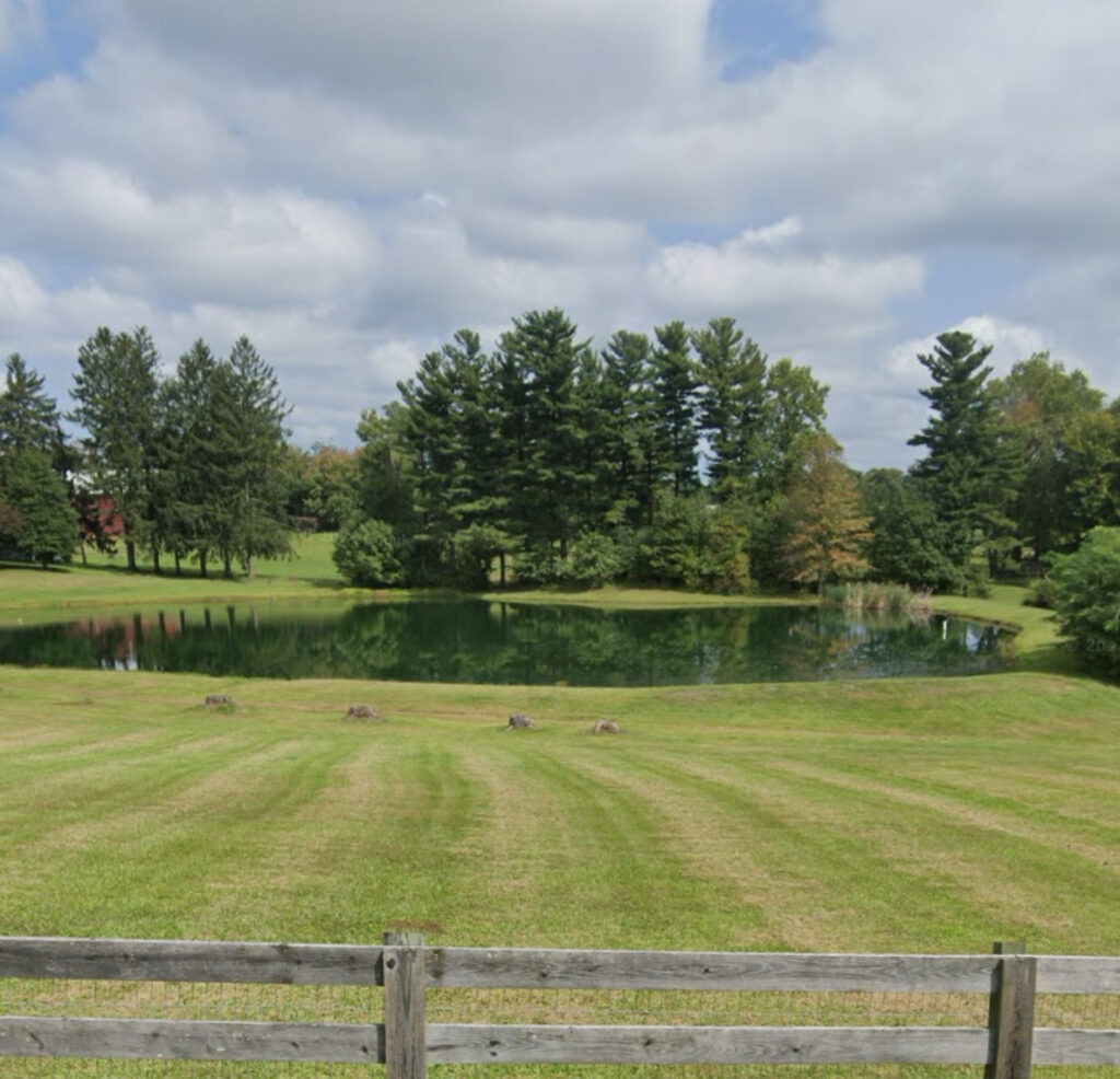
On a farm called Four County Farm, Parr’s Spring is now submerged in a pond. This distinctive geographic juncture is said to be marked by a contemporary concrete marker and submerged stones. It is not recommended to visit without permission because it is on private property.
You may view more pictures here. References:
Natural Resources Department of Maryland.State Park along Patapsco River.DNR in Maryland
Baltimore Sun.Four counties come together in the spring.October 14, 2011, Baltimore Sun
Government of Carroll County.Carroll County’s history.Carroll County, Maryland